
In a world increasingly reliant on GPS navigation, it can be both refreshing and empowering to explore alternative ways to navigate without relying on a satellite signal. Whether you find yourself in an unfamiliar city or exploring the great outdoors, there are a plethora of methods at your disposal that can guide you towards your destination. From using a compass and map, to utilizing landmarks and natural cues, this article will uncover the best strategies for navigating sans GPS. So grab your sense of adventure and prepare to discover the secrets to finding your way with confidence and grace.
Paper Maps
Advantages of using paper maps
Paper maps are a reliable and traditional way to navigate, and they offer several advantages over digital maps. One of the main advantages is that paper maps do not rely on technology or power sources, making them a dependable tool in any situation. Additionally, paper maps provide a broader view of the surrounding area compared to the limited screen size of electronic devices. They allow you to see the bigger picture and get a better understanding of the terrain and landmarks. Paper maps also allow for easy annotation and customization, letting you mark your route or add personal notes.
How to read and interpret paper maps
Reading and interpreting paper maps may seem daunting at first, but with a little practice, it becomes quite simple. Start by familiarizing yourself with the map’s legend, which provides important information about symbols, colors, and other features on the map. Understanding the scale is crucial in determining distances accurately. Most paper maps include latitude and longitude lines, which can help you pinpoint your location. To navigate using a paper map, align the map with the landmarks or visible features around you, and use a compass or the position of the sun to determine the direction.
Where to find paper maps
Finding paper maps may be a bit challenging in the digital age but not impossible. Local bookstores often carry maps specific to the area. Visitors’ centers, national park offices, or tourist information centers are also excellent places to find paper maps, especially for specific regions or hiking trails. Online retailers and specialized map stores are an excellent option for purchasing topographic and detailed maps. Additionally, many smartphone apps now allow you to print custom paper maps at home, giving you the flexibility to create personalized maps for your specific needs.
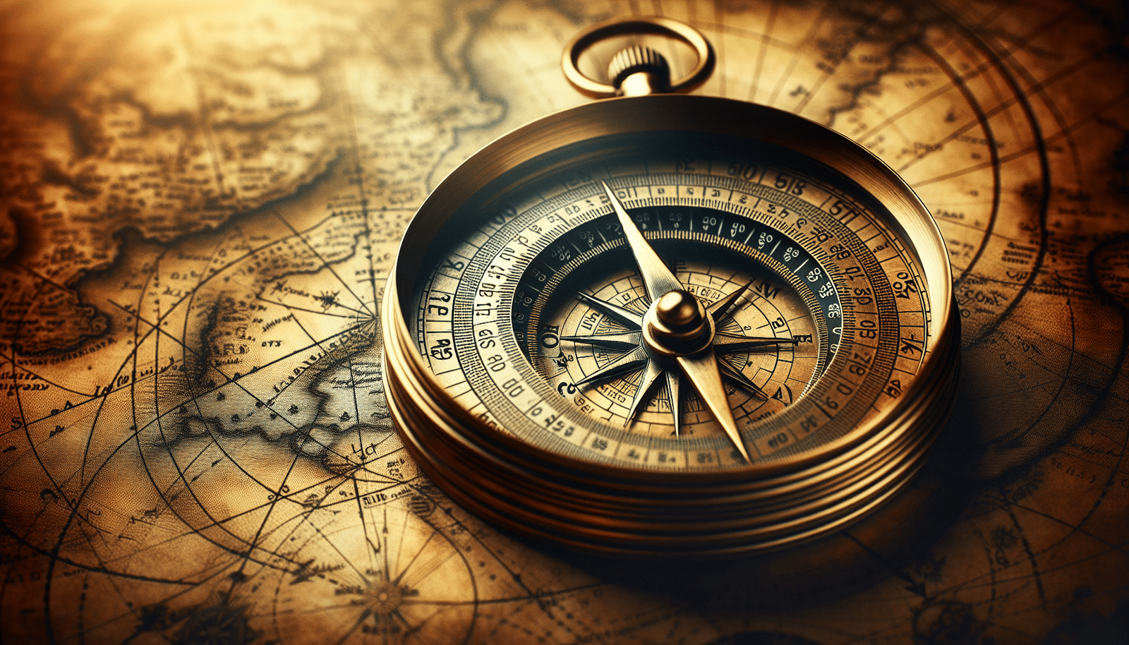
Compass
Understanding the basics of using a compass
A compass is a reliable and essential tool for navigation. It consists of a magnetic needle that aligns itself with Earth’s magnetic field, indicating the cardinal directions. To use a compass, hold it flat, ensuring the needle can move freely. Rotate your body until the needle aligns with the North marker on the compass. Once the needle is aligned, the compass can be used to determine other directions accurately. It is important to keep the compass away from any magnetic objects, as they can interfere with its accuracy.
Navigating with a compass
Once you understand the basics of using a compass, you can navigate using its features. If you have a specific destination in mind, you can use the compass to determine the direction you need to travel. Simply hold the compass level and rotate your body until the needle aligns with the desired direction. Keeping this alignment, walk in that direction, periodically checking the compass to ensure you stay on track. A compass can also be used to reorient oneself if you become disoriented while navigating.
Different types of compasses
There are various types of compasses available, each with its own advantages depending on your needs. A baseplate compass is a versatile and commonly used type. It features a transparent baseplate with ruler markings and a rotating bezel for determining directions. Lensatic compasses, often used by hikers and military personnel, have a sighting mechanism and a cover that protects the compass face. Thumb compasses are smaller and attach to your thumb or finger for quick and easy reference while running or orienteering. Choose a compass that suits your activities and preferences.

Landmarks and Visual Cues
Identifying and using landmarks
Landmarks are prominent features in the environment that can be used for orientation and navigation. Mountains, rivers, distinctive buildings, or even unique trees can serve as landmarks. When using landmarks, take note of their position on the map and compare them to your surroundings. This will help you confirm your location and stay on track. It is important to choose reliable, easily identifiable landmarks that can be seen from multiple angles to ensure accurate navigation.
Using natural and man-made visual cues for navigation
Visual cues are visible features that guide you in a particular direction or confirm your location. Natural visual cues include the direction of the wind, the flow of water, or the growth patterns of plants. Man-made cues can include fences, power lines, or roads. These cues can be particularly helpful when hiking in open landscapes or unfamiliar territories. By observing and paying attention to these cues, you can navigate with greater confidence and accuracy.
Sun and Stars
Determining directions using the position of the sun
The sun can be a reliable source of direction during the day. To determine north, locate the sun at noon, and visualize an imaginary line directly between you and the sun. This line will be roughly aligned with the north-south axis. In the Northern Hemisphere, the sun will be in the southern sky, while in the Southern Hemisphere, it will be in the northern sky. By understanding the sun’s position at different times of day, you can estimate other directions as well.
Using stars for navigation at night
Stargazing has been used for centuries as a means of navigation. By identifying specific constellations or stars, you can determine your direction. The North Star, also known as Polaris, is particularly useful for finding north in the Northern Hemisphere. It can be located by finding the Big Dipper, a prominent constellation, and tracing a line through the two outermost “pointer” stars. In the Southern Hemisphere, the Southern Cross can be used as a reference point. Familiarize yourself with these celestial landmarks for navigation during nighttime adventures.

Dead Reckoning
Understanding dead reckoning as a navigation technique
Dead reckoning is a method of navigation that involves estimating your current position based on a previously known position, direction, distance traveled, and time elapsed. It requires constant awareness of your speed, direction, and elapsed time to maintain an accurate position estimate. While dead reckoning is not as precise as other navigation methods, it can still be a valuable tool when used in combination with other techniques.
Using distance, direction, and time to estimate position
To utilize dead reckoning effectively, you need to track your distance traveled, direction, and elapsed time. This can be done using a pedometer, pace count, or estimated distances based on landmarks. By determining your average speed and direction, and multiplying it by the elapsed time, you can estimate how far you have traveled. This information, combined with your previously known position, helps you estimate your current location.
Road Signs and Mile Markers
Paying attention to road signs
Road signs are a crucial navigational aid when traveling by vehicle. They provide vital information such as directions, distances to specific destinations, and warnings about road conditions. Pay close attention to road signs, as they can guide you along your route and help you make informed decisions. Familiarize yourself with commonly used symbols and their meanings to ensure you understand the information conveyed by road signs.
Using mile markers for reference
Mile markers are used to indicate distances on highways and major roads. They are typically small signs placed at regular intervals, often every mile or tenth of a mile. These markers can be valuable references for estimating distances and confirming your location. By knowing your starting point and recognizing the numbers on the mile markers, you can track your progress and accurately navigate to your desired destination.
Ask for Directions
Approaching locals for directions
When in doubt, don’t hesitate to ask for directions from locals. Most people are willing to help and provide guidance. Approach someone who appears approachable and ask politely for directions to your destination. Be prepared with specific details, such as street names or landmarks, to help them understand your needs better. Showing gratitude for their assistance is important and fosters goodwill.
Asking for directions at gas stations or convenience stores
Gas stations and convenience stores are convenient places to seek directions, especially when you are in unfamiliar areas. The staff at these establishments are often familiar with the local geography and can provide accurate guidance. Approach the counter or an employee and explain your destination. They may offer verbal instructions, draw a map, or even recommend the best routes based on their local knowledge.
GPS-Free Mobile Apps
Exploring navigation apps that work offline
While GPS is not available, there are still mobile apps that can assist with navigation. Some navigation apps offer offline features, allowing you to download maps for use without an internet connection. These offline maps can be accessed even in remote areas or places with poor cellular reception. By exploring and downloading such apps, you can have a backup navigation tool on your mobile device.
Downloading and using offline maps on mobile devices
To utilize offline maps on your mobile device, start by identifying and downloading a navigation app that offers this feature. Once installed, open the app and search for your desired map region. Depending on the app, you can select specific areas or entire countries for offline use. After downloading the offline maps, you can access them seamlessly even without an internet connection, providing you with a reliable navigation tool wherever you go.
Utilizing Public Transportation
Navigating using public transportation systems
Public transportation systems, such as buses and trains, can be an efficient and cost-effective means of navigation in urban areas. Understanding the routes, schedules, and fare systems is essential. Research the public transportation options available in the area you plan to visit and familiarize yourself with their websites or information centers. Take note of the nearest bus or train stops, routes, and any transfer points, ensuring a smooth travel experience.
Using bus and train schedules for route planning
Bus and train schedules are valuable resources when planning your journey. They provide information on departure times, routes, and stops, allowing you to create a detailed itinerary. Timetables can usually be found online, at transit stations, or in print. Plan your routes in advance by considering the time it takes between stops, transfer points, and the desired destination. By utilizing schedules effectively, you can navigate the public transportation system with ease.
Using Physical Markers and Waypoints
Creating and using physical markers
Physical markers can be used in various environments to aid navigation. These markers can be anything from small objects placed intentionally to mark specific locations to large natural features like rock formations. When creating physical markers, ensure they are distinctive and can be easily identified even from a distance. Use them as reference points on your map, making note of their position and how they align with your desired route.
Using waypoints for step-by-step navigation
Waypoints are specific geographic coordinates that act as markers along a route. They can be identified by latitude and longitude or by using dedicated navigation devices. By plotting waypoints along your desired route, you can navigate step-by-step, moving from one waypoint to the next. Waypoints serve as checkpoints and help you confirm that you are on track. Plotting them on your map or using a GPS device ensures a more accurate and efficient navigation experience.
Navigating without GPS may seem like a challenge in today’s digital age, but there are still numerous ways to find your way. Paper maps offer a reliable and versatile tool for navigation, allowing you to see the bigger picture and make personalized annotations. Understanding how to read and interpret paper maps is essential, as it opens up a world of possibilities for exploration. Additionally, a compass can be your trusted companion, helping you determine directions and ensuring you stay on the right path.
Landmarks and visual cues provide valuable reference points, both natural and man-made, that aid in navigation. By observing and recognizing these distinctive features, you can confidently navigate unfamiliar terrain. The position of the sun during the day and the stars at night can serve as celestial guides, allowing you to determine directions without the need for technological assistance.
Dead reckoning is a technique that involves estimating your current position based on previously known information. By using distance, direction, and time, you can make educated guesses about your whereabouts. Road signs and mile markers are essential when traveling by vehicle, providing valuable information and helping you stay on course.
When all else fails, do not hesitate to ask for directions. Locals and employees at gas stations or convenience stores are usually willing to help. Additionally, GPS-free mobile apps with offline capabilities can serve as a backup navigation tool. By downloading and accessing offline maps on your mobile device, you can navigate even without an internet connection.
Public transportation systems offer efficient navigation in urban areas, with bus and train schedules providing valuable route planning information. Physical markers and waypoints can also aid in navigation, providing tangible and specific points of reference.
Remember, navigating without GPS requires practice and familiarity with various techniques. By embracing these traditional methods, you can enhance your sense of direction and embark on exciting adventures with confidence. So ditch the GPS and explore the world around you with a map and compass in hand!